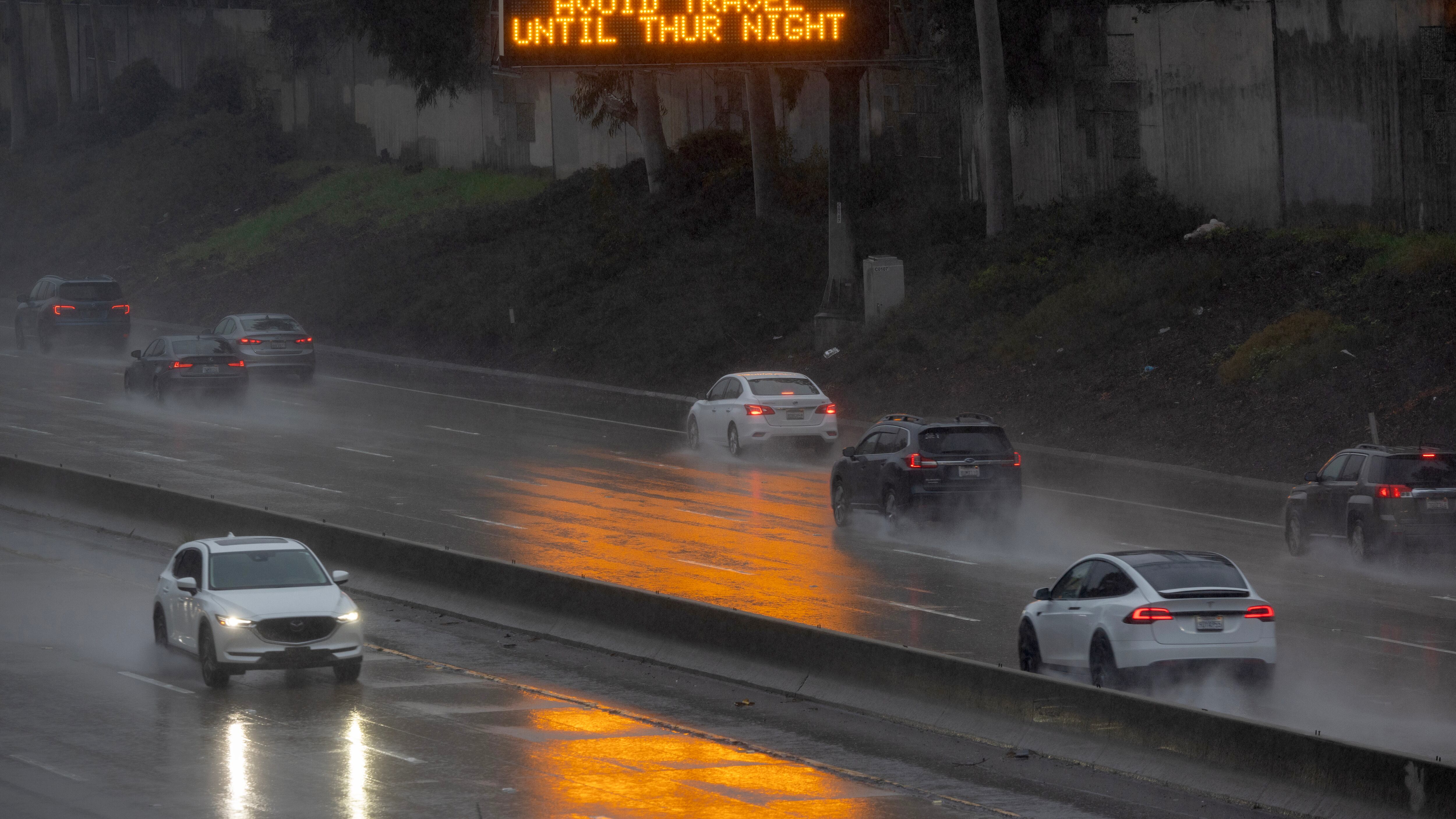
California residents are bracing for the arrival of two atmospheric river storms, also known as a “Pineapple Express,” that are forecast to dump several inches of rain, and upper-elevation mountain snow, across the state over the coming week.
Here’s what we know about the weather pattern.
What is a Pineapple Express?
The National Oceanic and Atmospheric Administration defines atmospheric rivers as “narrow regions in the atmosphere that transport much of the moisture from the tropics to northern latitudes.”
When those bands of moisture originate in the tropical Pacific Ocean, in the vicinity of Hawaii, and focus their energy on the West Coast of the U.S. mainland, they are known as a Pineapple Express.
Starting on Wednesday and lasting a week, two Pineapple Express storms will take aim at California, unleashing several inches of rain along with high winds.
Breathtaking satellite imagery of a stunning mid-latitude cyclone off the West Coast that will steer a significant atmospheric river into California tomorrow. pic.twitter.com/3hl49Wnq12
— Colin McCarthy (@US_Stormwatch) January 30, 2024
“This is a true atmospheric river. A classic, moderate-to-strong atmospheric river,” UCLA climate scientist Daniel Swain told reporters during a Tuesday webcast. “It is also a Pineapple Express-type atmospheric river.”
Timing of the two storms
The upcoming storms will “affect all of California’s major population centers,” Swain said.
The first, which is due to arrive in Northern California on Wednesday, could bring 2 to 4 inches of rain in some locations, according to computer models, as well as winds measuring over 30 miles per hour.
An impactful storm system will bring rain and wind to the area today and tonight. Minor flooding of streams and roadways is expected along with the potential for downed trees and power outages. Stay safe and use caution during your commute today. #cawx pic.twitter.com/JA6f1roNE2
— NWS Bay Area 🌉 (@NWSBayArea) January 31, 2024
“Storm No. 1 will be moderate to strong. Nothing earth-shattering. It won’t be any catastrophe, but it could cause fairly widespread urban and small stream flooding in Northern California,” Swain said, adding, “The heavier rains and the stronger winds with storm No. 1 are probably going to be from the Monterey Bay area northward. So this will be a storm that affects the [San Francisco] Bay Area during the evening commute.”
Wind is among the bigger concerns with today's weather system. Strong and gusty southerly winds will develop through the day and into tonight. Given saturated soils downed trees and resulting power outages are likely. Stay safe out there! #cawx pic.twitter.com/iSddECletx
— NWS Bay Area 🌉 (@NWSBayArea) January 31, 2024
Because the first storm will pack mostly warm air, only the higher mountain elevations are expected to see significant snowfall totals.
“It might be a different story with storm No. 2,” Swain said, noting that colder air will accompany the second dose of stormy weather that is expected to arrive in the state on Sunday.
“With the Sunday-Monday storm in the Sierra Nevada, there actually could be quite a bit more snowfall,” he said.
Storm No. 2 is expected to wallop Southern California with “very heavy rainfall,” Swain said, and bring especially strong winds, as high as 70 miles per hour, to the northern part of the state.
Potential for flooding
The two storms will carry the risk of flooding, with the first threatening some urban and small stream areas that are often overwhelmed by extreme amounts of precipitation over a short period of time, Swain said.
“A good portion of what falls tomorrow could fall very quickly, which would increase the likelihood of some flooding in Northern California,” he added.
But the second storm is more concerning and will pose a greater risk to Southern California. A potentially record-breaking low-pressure system will intensify as it approaches the coast on Sunday, dumping rain on ground already saturated from the first system.
An atmospheric river will begin to impact the Western U.S. tonight and produce widespread low elevation rain, heavy mountain snow, and gusty winds.
— National Weather Service (@NWS) January 30, 2024
Follow your local office by visiting https://t.co/GWrG0hTRHN pic.twitter.com/ncBxXhV7Cn
“Southern California could get two to three times as much rain as Northern California [receives in the first storm] from the second storm,” Swain said.
According to computer models, the Los Angeles region could see upward of 7 inches of rain before the second system passes next Wednesday. While some northern portions of the state could see even more than that amount of rain, the bulk of it will fall in Southern California from Sunday through Wednesday.


